COOPER RIVER DIVE CHARTERS

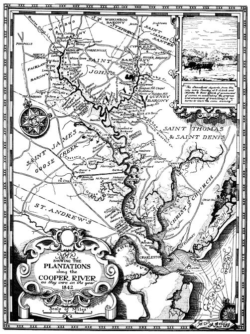 |
This 1842 map shows plantations location along the Cooper River this map is if from the book " A Day On The Cooper River" by John Beaufain Irving, Charleston, 1842 and then released as a 2nd edition, edited by Louisa Cheves Stoney in 1932. It tells a story from the
author's point
of view the history of the river from Charleston to Moncks
Corner's Santee Canal. Telling the stories of life
of people and places along
the river, as the steamboat traveled up river and
then returned to Charleston the same evening.
Historic
Resources of the Cooper River, ca. 1670-ca. 1950
-
|

Help Report Manatee Sightings In SC
![]() Simply the Best In Blackwater Diving
Simply the Best In Blackwater Diving
![]()
Copyright 2008
S&J Ventures
260 Amy Drive
Goose Creek